As coastal flood risks become more frequent in the future due to climate change, this research provides a fresh approach to making complex data and information more accessible and actionable
Understanding coastal flood risks from storm tides and extreme events
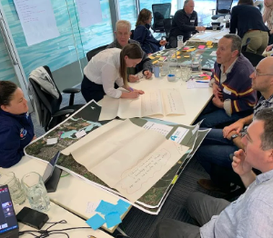
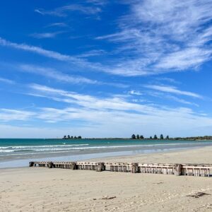
Sea-level rise is increasing the frequency of inundation of coastal places. Events that were once considered acute nuisances are now evolving into recurring issues. In addition to tidal flooding, the rare combination of a major storm surge and high tides, can exacerbate coastal flooding, and with sea level rise can lead to the possibility of major inundation and chronic impacts. This project aims to equip coastal managers, adaptation professionals, and decision-makers with data and information to improve understanding of coastal flood risks from storm tides and extreme events. We will develop case studies for better understanding and practical application to support community engagement and inform adaptation strategies.
Empowering decision-makers for a resilient future
Co-developing user-friendly tools, such as flood likelihood overlays, will help stakeholders understand the frequency and likelihood of coastal flooding, enabling more informed decision-making for infrastructure planning and climate adaptation.
The project will contribute to improving flood prediction models, including the development of new flood layers and inundation maps tailored to selected case study locations. By fostering collaboration with state governments, First Nations communities, and climate adaptation experts, the project will support the creation of actionable guidance to enhance resilience and facilitate better coastal planning for the future.
Want to know more?
Please contact the project leads, Julian O’Grady, CSIRO and Helen Bloustein, DEECA.