September 24, 2026
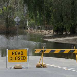
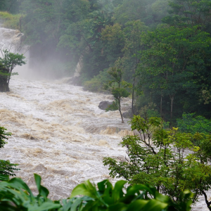
While it might put a damper on your picnic plans, sudden heavy downpours (known as short-duration precipitation extremes) can also cause serious problems. Streets, homes, and buildings can flood quickly, overwhelming stormwater systems. Intense rainfall can destabilise soil, triggering landslides. And runoff can carry pollutants like oil, chemicals, and waste into rivers and oceans.
Australia’s first National Climate Risk Assessment (NCRA), released in September 2025, and State of the Climate 2024, highlight how climate hazards, in particular extreme rainfall, are intensifying and shifting. They show that flash flooding and convective storms are expected to increase in frequency and intensity. That’s why we study these events: to understand them better now, and prepare for what’s coming.
How do we study them?
We use a mix of real-time observations and future-focused modelling:
- Rain gauges and radar to measure rainfall as it happens.
- Hydrological monitoring to track how rain becomes runoff and flooding.
- Satellites to observe large-scale rainfall and land changes.
- Historical data to spot trends.
- Urban drainage models to simulate how water flows through cities.
- Local observations to fill in the gaps.
Looking ahead, we use climate models to simulate how rainfall patterns might change in the future under different warming scenarios. That’s where the CORDEX (Coordinated Regional Climate Downscaling Experiment) and the World Climate Research Programme come in, providing tools to zoom in on local impacts.
Why does this research matter?
Preparing for future climate means using this science to make smarter decisions:
- Engineers use climate data to size stormwater systems and design resilient infrastructure.
- Urban planners identify areas at risk and integrate green infrastructure.
- Government decision-makers update codes and prioritise funding based on future risk.
- Emergency services need better forecasting and early warning systems.
- Insurers and analysts assess how future rainfall affects claims and premiums.
- Climate communicators and knowledge brokers help translate science into information that is accessible and actionable.
Enter SHEP
The Sub-hourly Extreme Precipitation (SHEP) project is a major research effort supported by:
- NESP (National Environmental Science Program)
- CORDEX (Coordinated Regional Climate Downscaling Experiment)
- WCRP (World Climate Research Programme)
SHEP uses high-resolution modelling to simulate thunderstorms and heavy showers, helping us understand how short, intense bursts of rain are changing and what that means for cities across Australia and New Zealand.
What’s next?
As our climate continues to change, short, intense bursts of rain are becoming the new normal. Climate risks are evolving, and we need to evolve with them.
Initiatives like SHEP aren’t just about better models, they’re about helping engineers, planners, communities, and decision-makers stay one step ahead. By understanding how these events are changing and where, we can design resilient infrastructure , protect the most vulnerable, and make informed choices about where and how we build.
When the next downpour hits, it won’t just be a weather event, it’ll be a test of how well we’ve listened, learned, and planned.
Find out more about our rainfall webinar series >