July 2, 2026
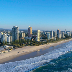
Western Port Bay, east of Melbourne, is a Ramsar-listed wetland of international importance, supporting extensive saltmarsh, shorebird habitat and other valued coastal ecosystems and community spaces. 🐦🌱🦆
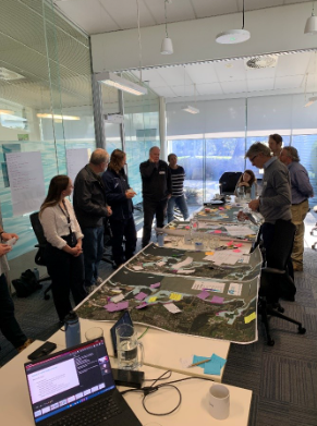
Recently, our Communicating Coastal Floods project team held a joint knowledge exchange workshop with the Catchment Management Authority – Melbourne Water, local councils, state government, Parks Victoria, BirdLife Australia and the Western Port Biosphere to discuss how our new storm-tide flood frequency science can be applied across the Western Port Ramsar site, and how this information can support ecological interpretation, planning and future adaptation decisions.
Using hourly water-level observations from the west and north of the Bay, together with extreme sea-level analysis and new modelling, we developed flood-frequency mapping that can be overlaid with ecological and other datasets to compare past and future changes to coastal areas. 🗺️
A key insight is that Western Port saltmarsh terraces sit above the normal astronomical tidal range and are instead currently inundated during less frequent storm-assisted high-water events. This places parts of the saltmarsh system within a probabilistic sea-level framework, where inundation by the sea is episodic and may not occur every year.
In future, with sea level rise, storm surge events coinciding with high tide are expected to occur more often, increasing the risk of chronic or repeated inundation. Understanding these landscapes and what will be impacted has implications for interpreting coastal evolution, ecosystem vulnerability, migration and displacement under sea level rise.
Post-workshop feedback from Heremaia Titoko, Western Port Ramsar Partnership Coordinator at Melbourne Water, notes the session has sparked off a range of internal discussions within participating organisations. This includes around how the data and information can help identify future impacts to assets, whether that be infrastructure or bird roosting sites, and how it can inform further engagement around how extreme sea levels will play out differently around the site.
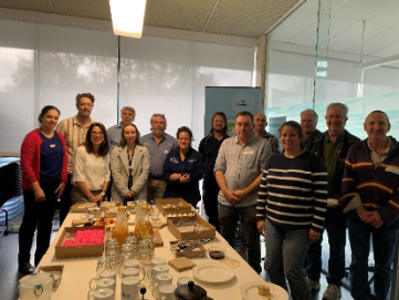
A big thanks to Melbourne Water for hosting the session with us and for the Hub project team, Julian O’Grady, Helen Bloustein and Ramona Dalla Pozza for facilitating such a productive and collaborative workshop to bring together the science, management, decision making and ecological perspectives. 👏